WalkersGuide App
WalkersGuide is a navigational aid primarily intended for blind and visual impaired pedestrians. It calculates routes and shows nearby points of interest. The project consists of an Android client and a server component. The latter performs the route calculation. The map data is provided by OpenStreetMap, a project to create a free map of the world.
Main features
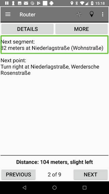
- Calculate routes optimized for blind and visually impaired users
- Explore layout of intersections
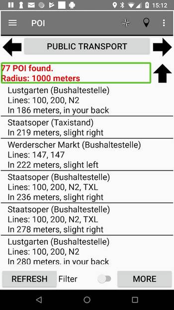
- Show nearby POI
- Find train and bus stops and get their next departures
- Simulate any street address
- Create your own favorite points
The application is fully accessible with Android’s screen reader Talkback.
Feel free to request new maps.