OpenAthena 앱
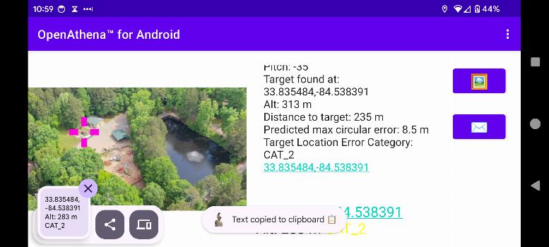
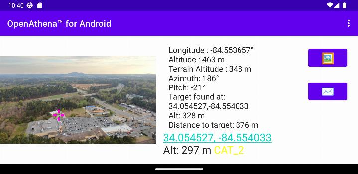
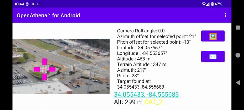
OpenAthena™는 소비자 및 전문 드론이 이미지로 정확한 위치를 파악할 수 있도록 하는 프로젝트입니다. 이는 센서 메타데이터와 오프라인 준비가 가능한 디지털 고도 모델을 결합하여 관측되는 대상의 즉각적인 위치를 제공함으로써 이루어집니다.
🖼️👨💻 + 🧮⛰️ = 🎯📍
OpenAthena에 필요한 디지털 고도 모델 GeoTIFF 파일을 얻는 방법에 대한 지침은 이 링크를 사용하세요.
새로운 기능 0.25.0
- Improved target location error estimation using a new formula based on slant range.
- Enhanced DEM downloads using Copernicus GLO-30 data for better accuracy compared to SRTM.
- Updated app, UI, and submodules for compatibility with Android 15.
- Fixed a crash caused by orientation changes when re-entering the app.
- Improved calculation reliability for cropped images.